

Proposals
Creating a high-quality and sustainable development
Our vision is to create a high quality and sustainable new development across land west of Ninfield Road that responds to local housing needs while respecting the landscape character and setting of the site.
The emerging proposals aim to deliver a well-designed residential environment that integrates sensitively with its surroundings and provides a positive addition to the north western edge of Bexhill. The proposals place a strong emphasis on green infrastructure, public open space and walkable connections, creating attractive spaces for residents and the local community.
Chestnut Meadow is an active caravan park and the existing mobile homes and ancillary support buildings will be retained. We are proposing to develop the touring caravan area and associated fields surrounding this.
We are committed to working collaboratively with Rother District Council, local residents and other stakeholders to ensure the proposals brought forward through separate planning applications are informed by local knowledge and reflect the area’s character, while supporting the district’s longer-term housing, environmental and placemaking objectives.
Key features
Delivering benefits for the local area
- In the region of 500 new homes, including 30% affordable housing, contributing to meeting local housing needs as identified in the Draft Local Plan. The new homes will be a mix of 1, 2, 3 and 4 bedroom homes.
- A community hub to act as a neighbourhood centre to meet the needs of the local community and bring both new and existing residents together. This could include new community space, a local shop and café.
- A landscape-led residential development, informed by detailed landscape and visual assessment, designed to integrate sensitively with its surroundings and respect the site’s character and setting.
- Significant green infrastructure and public open space, including landscape corridors and accessible green areas for residents and the wider community.
- Retention and enhancement of existing Public Rights of Way, alongside new and improved walking and recreational routes to strengthen local connectivity.
- Proposed play and recreational spaces, integrated within the landscape framework to support healthy, active lifestyles.
- Ecological enhancements, including habitat protection, landscape corridors and biodiversity improvements delivered as part of the overall landscape strategy.

The site
Emerging Site Masterplan
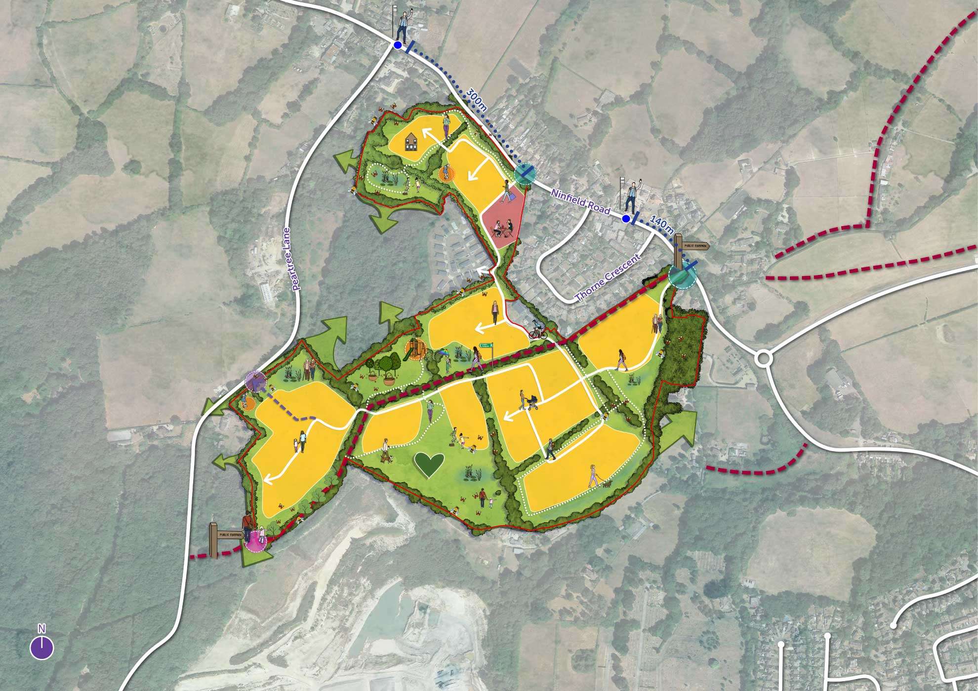
 Red Line (27.6 ha)
 Public Rights of Way
 Existing bus stop
 Proposed access points
 Pedestrian gateway
 Emergency access point
 Landscape corridors
 Focal green space
 Proposed play area
 Proposed street network
 Proposed active travel routes
- Proposed residential parcel
- Proposed mixed-use parcel
New homes across the site
High-quality housing that meets local needs
The proposed development will deliver a mix of small, medium and family-sized homes, providing a wide range of accommodation to help meet identified housing needs within Rother. The homes will be set within a strong landscape framework, with generous green open space and opportunities for walking and recreation forming part of everyday life.
While detailed design and layout will be matters for a future Reserved Matters application, the proposals will seek to create a safe, accessible and attractive residential environment that supports health, wellbeing and long-term quality of life.

Affordable housing
Delivering affordable homes that meet local needs
The proposed development will be made up of 30% affordable homes in line with local planning policy. There is a considerable need for affordable homes in the district, with over 1000 households on Rother District Council’s Affordable Housing Register as of April 2025.
What do we mean by affordable housing?
This can take the form of different tenures and can include the following:
Shared ownership housing is provided through a Registered Housing Association and helps households who can afford a small mortgage, but that are not able to afford to buy a property outright.
To be eligible for a shared ownership property, the annual household income can be no more than £80,000 and applicants must be registered on the Home Buy Register.
It enables purchasers to buy a share between 10% and 75% of the home’s full market value and then pay rent to the landlord for the share they own.
Social rented housing is owned by local authorities and Registered Providers, for which guideline target rents are determined through the national rent regime.
The rent is calculated using a set formula that takes into account the value of the property, the average earnings in the area and the number of bedrooms.
Social Rented properties are the most affordable tenure type, typically around 60% of an open market rent. Housing Benefit is available to qualifying households where they are unable to pay their Social Rent.
Intermediate housing includes homes for rent and sale provided at a cost above social rent but below market levels.
Affordable rent (or intermediate rent) is housing is let by Local Authorities or Registered Providers to households who are eligible for Social Rented housing. Affordable Rent is subject to rent controls that require a rent of no more than 80% of the local market rent.
Rent to buy – you rent a newly built home at approximately 20% below the market rate for up to five years (exact period of time varies by property). During that time period, you have the option to buy the property or to buy part of the property under a Shared Ownership scheme. When you get to the end of the time period, you either have to buy part of the property or move out.

Open spaces
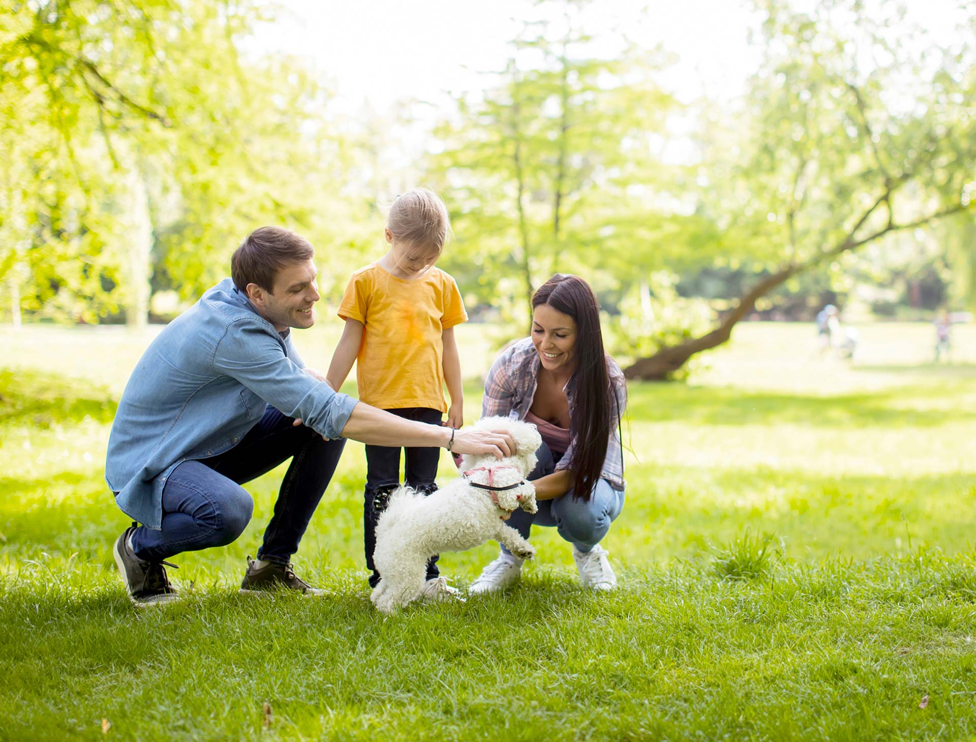
Providing space for all to use
Public open space will be an important part of the proposed development, providing a variety of spaces for recreation and relaxation. The aim is to create open spaces that are practical, welcoming and suitable for people of all ages to enjoy as part of everyday life.
Across the site, open spaces could support a range of uses, including children’s play areas, benches and seating, footpaths and cycle paths, and outdoor exercise equipment, alongside informal green areas and quieter spaces to relax or enjoy nature. These spaces are intended to encourage outdoor activity, social interaction and healthy lifestyles.
Community hub
A place where the community can come together
A flexible community space will be delivered on site, at the heart of the development. The space will provide residents a place to come together to facilitate social cohesion. As part of the consultation, we’ll be looking to gather ideas on what type of space could be most used and we would love to discuss this in greater detail with you to ensure it is reflective of local needs. This could provide a shop, café, community space or a children’s nursery.

Landscape-led design
Green infrastructure and biodiversity at its heart
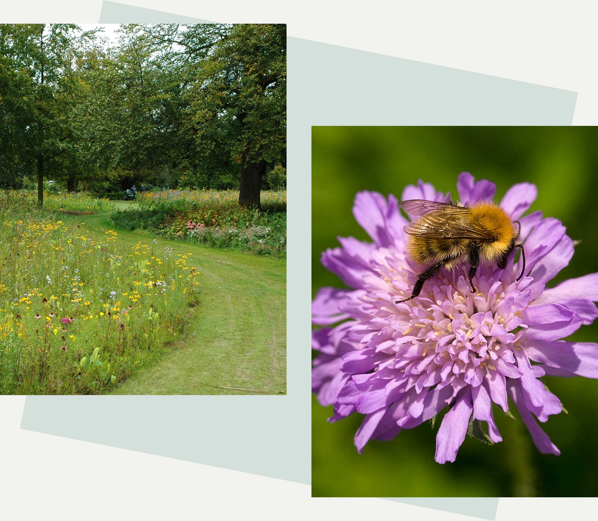
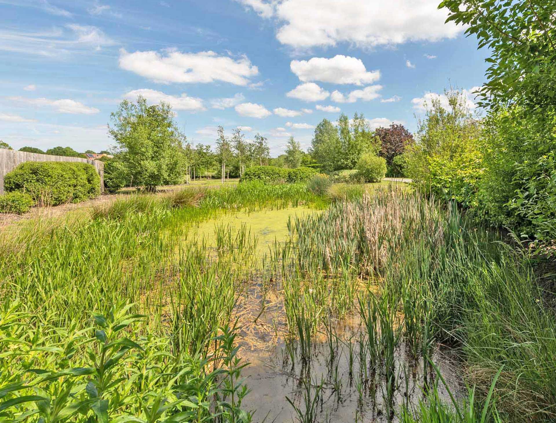
The emerging proposals place landscape and green infrastructure at the heart of the development. A network of public open spaces, landscape corridors and green links is proposed to help structure the layout, provide accessible outdoor spaces and support biodiversity across the site. The landscape strategy has been informed by a programme of ecological surveys undertaken across the site since 2024.
The site is bounded by native hedgerows, trees and areas of woodland, with ponds located nearby. These existing features will be retained and enhanced wherever possible, with development focused on areas of lower ecological value and more sensitive habitats along the site boundaries protected.
The proposals incorporate a range of mitigation and enhancement measures delivered through the landscape strategy, including the retention and strengthening of boundary habitats, new planting and the creation of connected green corridors. Additional habitat creation will include new parkland, hedgerows, an orchard, areas of wildflower meadow, wet grassland and species-rich swales. Together, these measures will help support biodiversity, improve habitat connectivity and ensure the development responds positively to its environmental context.
Site access
A well-connected and accessible place
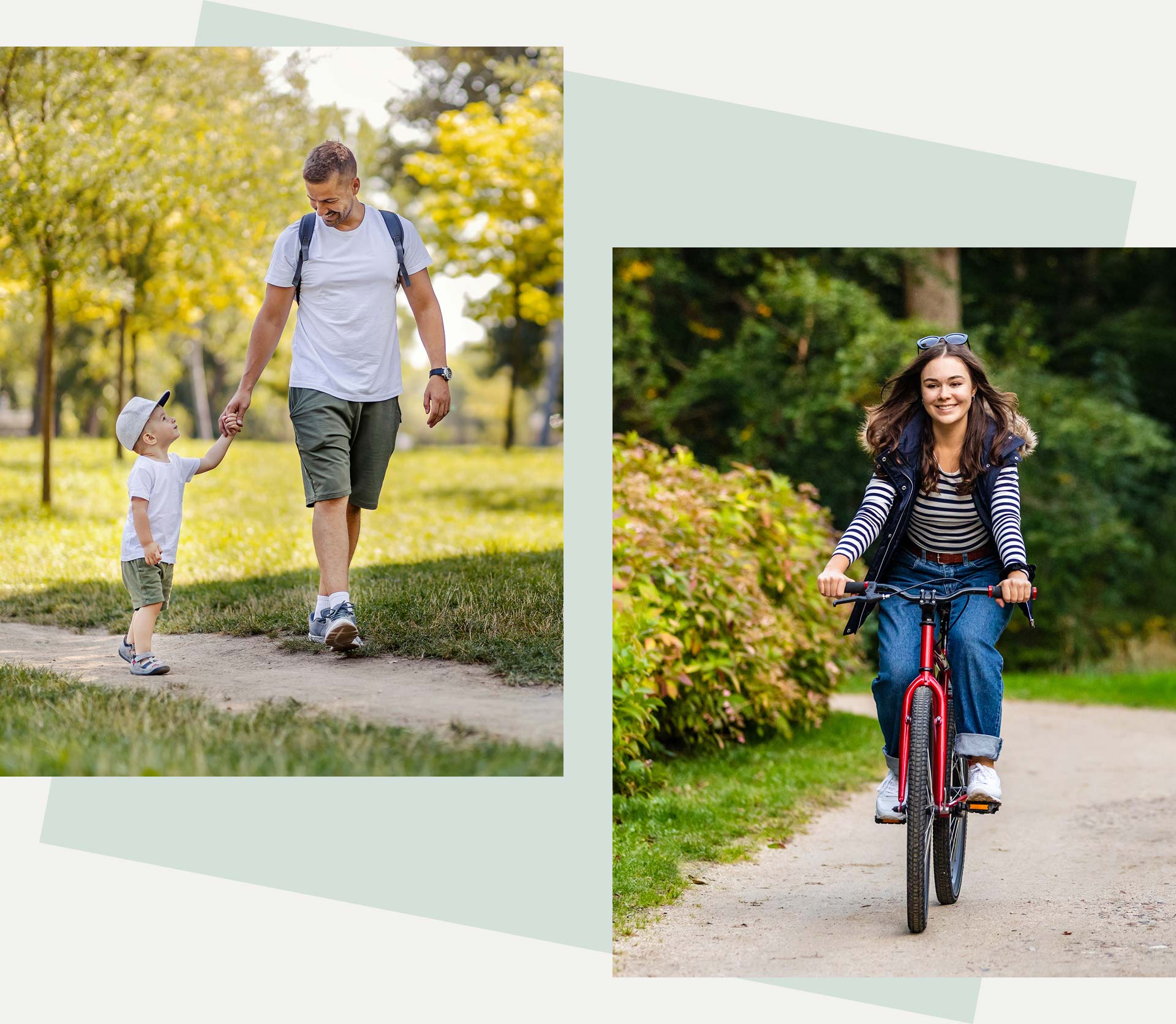
The emerging proposals place a strong emphasis on safe and convenient movement within and around the site. Access arrangements have been designed to respond to the site’s context, with vehicular access taken from Ninfield Road and a clear internal street network to serve new homes.
Walking and recreational movement form a key part of the proposals. Existing Public Rights of Way would be retained and enhanced, with new and improved routes proposed to create better connections across the site and to the surrounding area.
The overall approach seeks to balance vehicular access with high quality pedestrian and recreational routes, ensuring that movement through the site is well integrated with the landscape framework and contributes positively to the character and usability of the development.
Transport assessments have been carried out to review the likely walking, cycling and bus routes that would be taken by residents living on the development that would see connections to key local destinations including central Sidley, Grenleigh School, Bexhill Academy and Collington and Bexhill Railway Stations.
As part of this assessment, walking routes were carefully reviewed against key criteria such as attractiveness, comfort, safety, clarity and directness. This process identified several opportunities to improve the local walking environment, helping to make journeys safer, easier and more enjoyable for everyone.
Potential improvements include wider footways to better accommodate shared use by pedestrians and cyclists, additional crossing points with dropped kerbs and tactile paving along Ninfield Road and its adjoining side streets, and the provision of a new bus shelter at the northbound stop at Lunsford’s Cross. These ideas will be developed in close partnership with ESCC Highways, ensuring that any improvements delivered as part of the scheme are appropriate in scale and tailored to local needs.
There are a total of five junctions that have also been reviewed to assess the existing road network, these include:
- A269 Ninfield Road / A2691 Haven Brook Avenue roundabout
- A2691 Haven Brook Avenue / A2691 Mount View Street / A2690 Combe Valley Way roundabout
- A269 Ninfield Road / Turkey Road roundabout
- A259 Belle Hill / A269 London Road / A259 Little Common Road / A269 Combe Valley Way signalised crossroads
- A259 Little Common Road / B2182 Cooden Sea Road / A259 Barnhorn Road / Chestnut Walk / Peartree Lane roundabout
We are working closely with ESCC Highways and National Highways throughout this process to ensure that the full impact of the development on the local highway network is carefully assessed and responsibly managed.

Drainage
Future-proofing the site
The Environment Agency’s Flood Map for Planning shows the site is located entirely within Flood Zone 1, which is land at a low risk of flooding.
A detailed Flood Risk Assessment (FRA) will be submitted with the planning application. The FRA will assess flood risk to the proposed development from all potential sources, and demonstrate that the development will not increase flood risk elsewhere.
It will also set out any appropriate mitigation measures required to ensure that the site remains safe for its lifetime and that wider flood risk is not adversely affected. To manage surface water runoff generated from within the site, an appropriate Surface Water Drainage Strategy which complies with the latest local and national guidance will be incorporated into the development to mitigate any increase in surface water runoff caused by development.
Surface water runoff from the development will be attenuated within above ground attenuation basins located at the lowest points of the site, which will be designed to accommodate a 1 in 100 year storm event plus a further allowance for climate change.
Surface water will then be discharged at the equivalent greenfield runoff rate. The use of Sustainable Drainage Systems (SuDS) to capture, treat and attenuate surface water runoff from the site before discharging, provides significant biodiversity and water quality benefits as well as serving as a drainage function.
Foul water will be managed separately and be discharged into the public foul sewer system.
Timeline
Overview of the application process
We are in the early stages of bringing forward our plans for land west of Ninfield Road, Bexhill. We have included an anticipated timeline of activity for the proposed development:
February 2026
Launch of consultation.
Spring 2026
Targeted submission of outline planning applications.
Autumn 2026
Expected determination of outline planning applications.